Services
In the era of technological advancement, FAA licensed professional drone pilots are revolutionizing various industries. Among the sectors experiencing a significant transformation are construction, real estate, and agriculture. Here's a closer look at how professional aerial drone services are reshaping these industries:
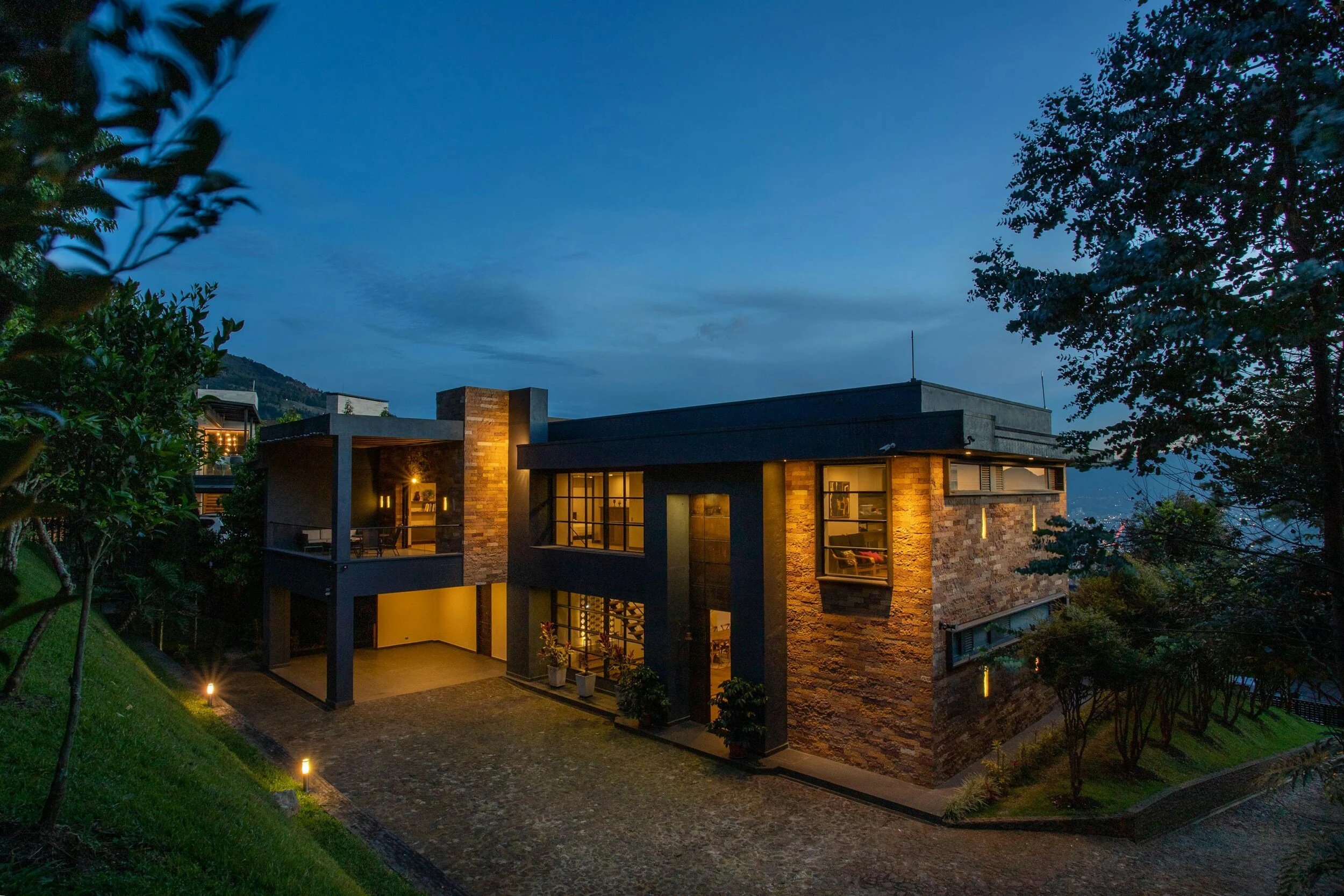
Real Estate: Elevating Property Marketing
Aerial Photography and Videography: Drones have transformed the way real estate is showcased. High-quality aerial photography and videography provide potential buyers with captivating views of properties, highlighting features such as location, size, and surroundings. This not only attracts more attention but also accelerates the sales process.
Virtual Tours and Inspections: Drones enable the creation of immersive virtual tours, allowing potential buyers to explore properties remotely. This is especially valuable for out-of-town or international clients. Additionally, drones can be employed for property inspections, identifying issues like roof damage or structural concerns without the need for physical presence.
Land Use Planning: Real estate developers leverage drones for assessing and planning land use. The data collected aids in evaluating the feasibility of projects, understanding environmental factors, and making informed decisions about the development potential of a given area.
Construction: Aerial Precision for Efficiency
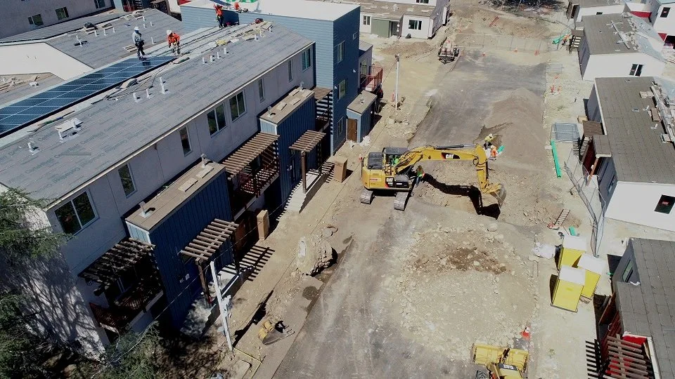
Surveying and Mapping: Drones have revolutionized the construction landscape by offering unparalleled efficiency in surveying and mapping. Equipped with high-resolution cameras and LiDAR technology, drones can rapidly collect accurate topographical data. This not only expedites the planning phase but also reduces costs associated with traditional survey methods.
Site Monitoring and Inspections: Drones play a crucial role in ongoing construction projects by providing real-time aerial views. Construction managers can remotely monitor sites, track progress, and identify potential issues promptly. This aids in efficient project management, enhancing safety, and minimizing downtime.
3D Modeling and Visualization: The ability of drones to capture high-quality imagery allows for the creation of detailed 3D models. Architects, engineers, and project stakeholders can visualize the entire project before it's completed, facilitating better decision-making and ensuring that the final result aligns with the initial vision.
Agriculture: Precision Farming for Increased Yields
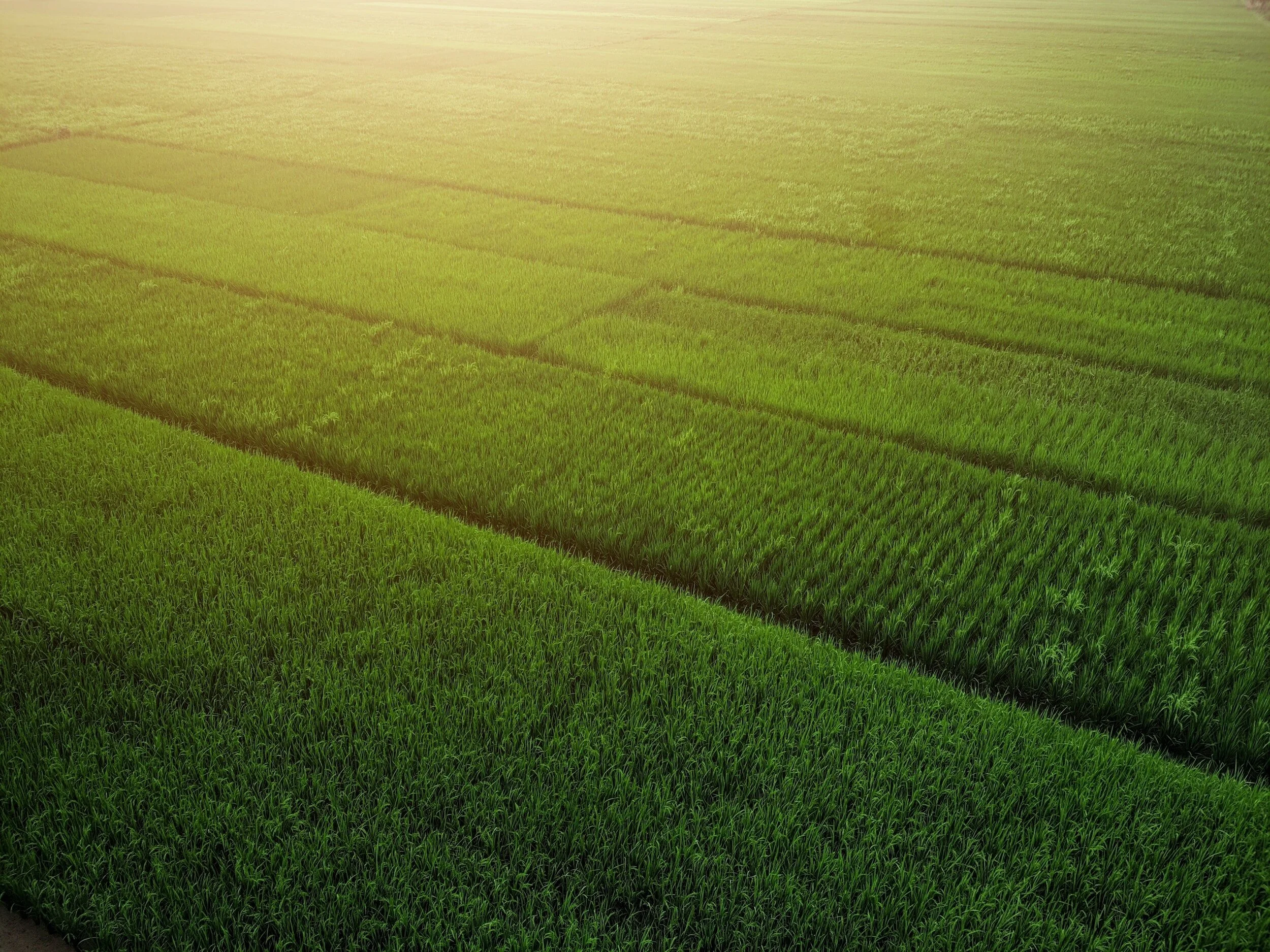
Crop Monitoring: In agriculture, drones equipped with multispectral and thermal cameras contribute to precision farming. Farmers can monitor crop health, identify pest infestations, and assess the effectiveness of irrigation practices. This data-driven approach allows for timely interventions, leading to increased crop yields.
Field Mapping and Analysis: Drones provide farmers with detailed maps of their fields, helping them analyze variations in soil composition and crop performance. This information supports precision agriculture practices, allowing for optimized resource allocation, reduced waste, and enhanced sustainability.
Livestock Management: Beyond crops, drones are employed in livestock management. They aid in monitoring animal behavior, assessing herd health, and even tracking the movement of livestock across large areas. This data contributes to better decision-making in livestock farming.